• Skip to primary navigation
  • Skip to main content
Featured Project: large, engineered log-jam structures to stabilise actively eroding streambank
catchment-solutions-logo
catchment-solutions-logo-white
Search
  • About
    • Vision, Capabilities & Values
    • Our board
    • Our team
    • Positions vacant
  • Work with us
  • Services
    • Water Quality Services
    • Agricultural Innovation and Support
    • Fisheries & Aquatic Ecosystems
    • Environmental Planning & Approvals
    • Ecosystem Rehabilitation & Repair
  • Projects
    • Featured Projects
    • Agricultural Innovation and Support
    • Ecosystem Rehabilitation & Repair Projects
    • Environmental Planning & Approvals
    • Fisheries & Aquatic Ecosystems
    • Water Quality Services
    • Archived Projects
  • News
  • Media
  • Contact
Project enquiry
Hide Search

diana

Remediation of Leitchs Crossing complete

diana · Sep 25, 2018 ·

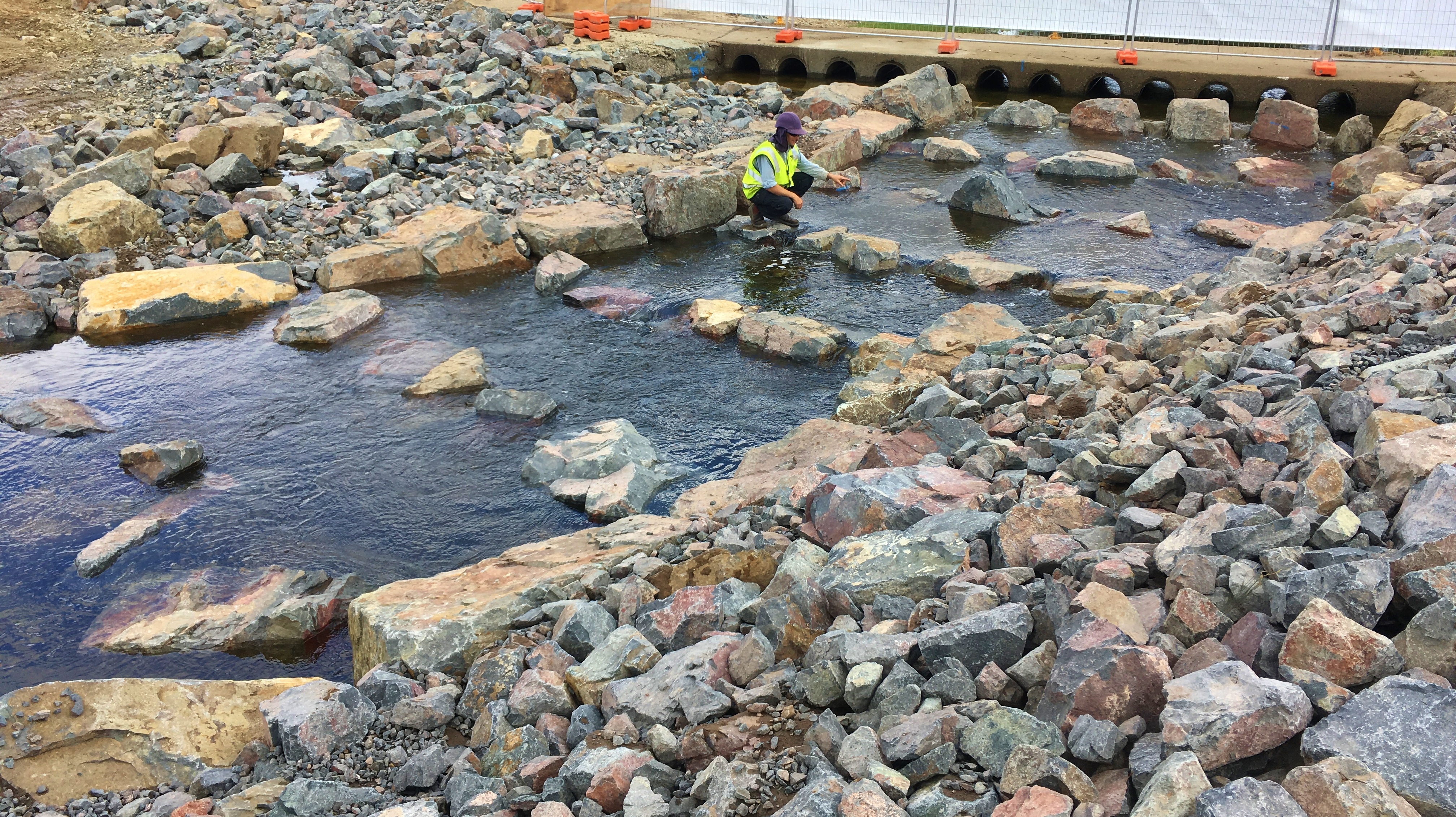
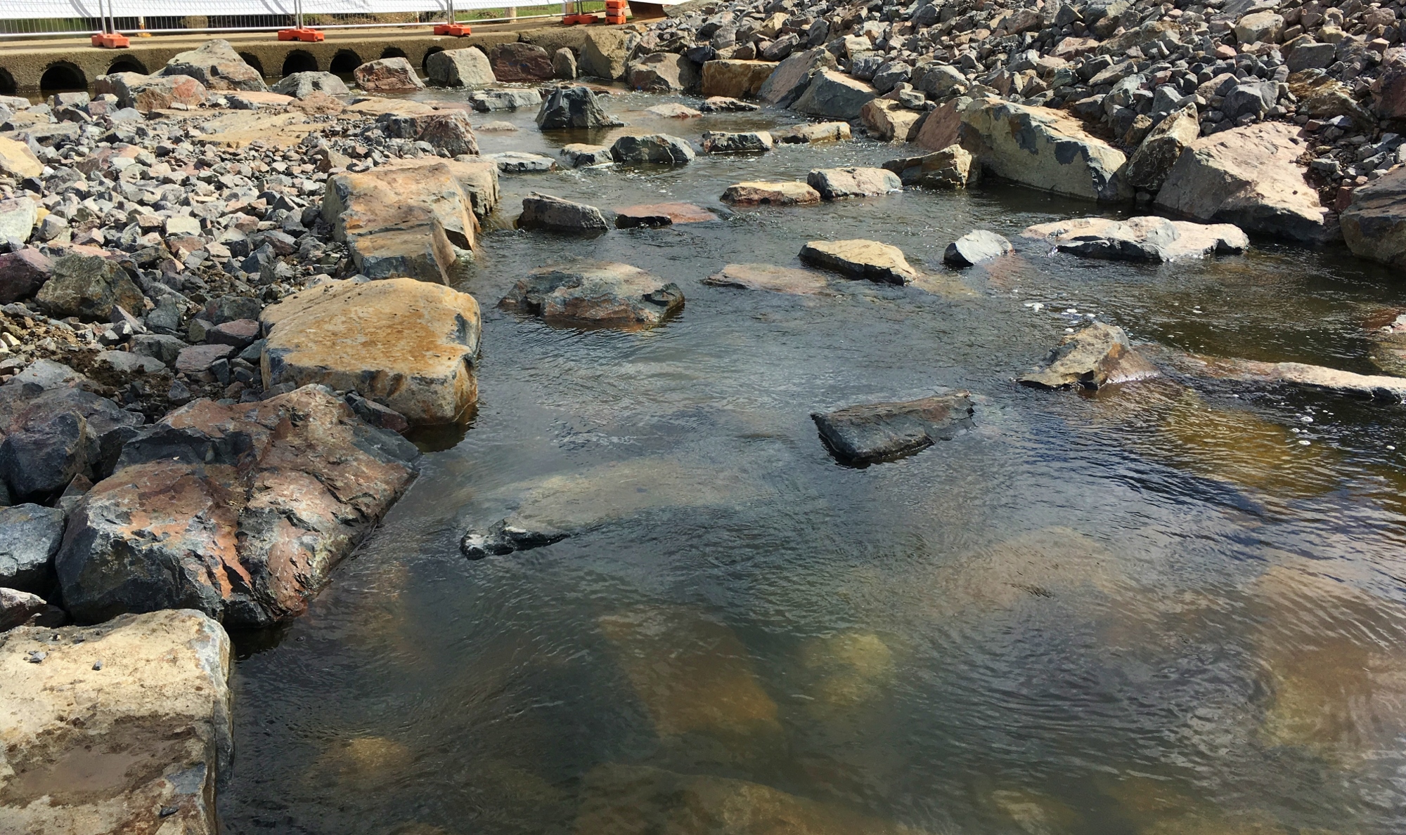
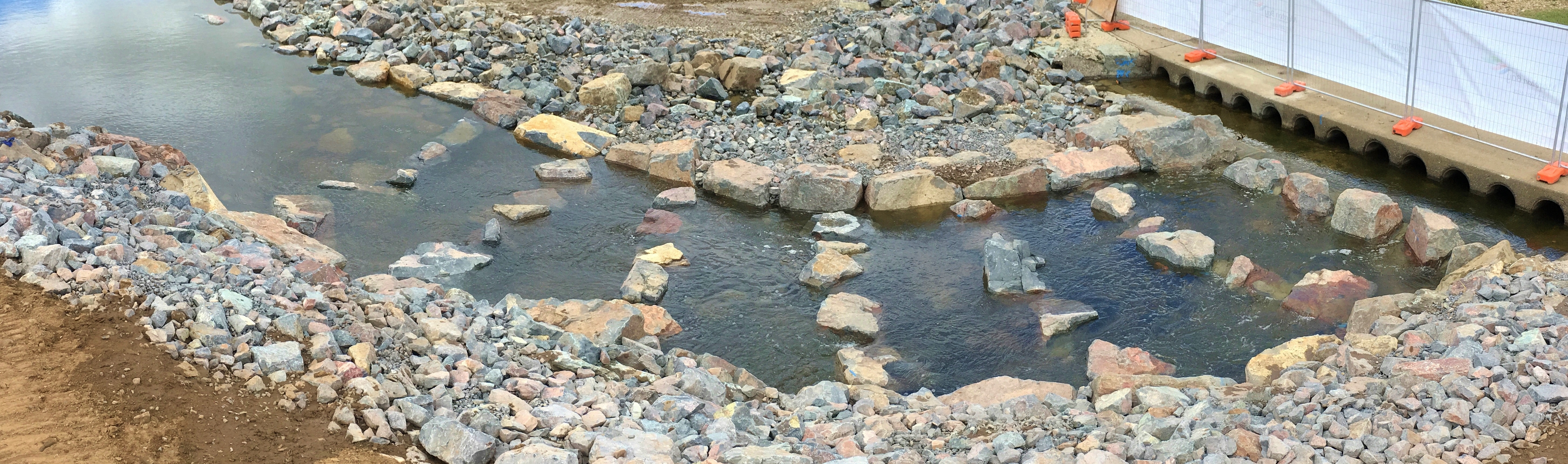
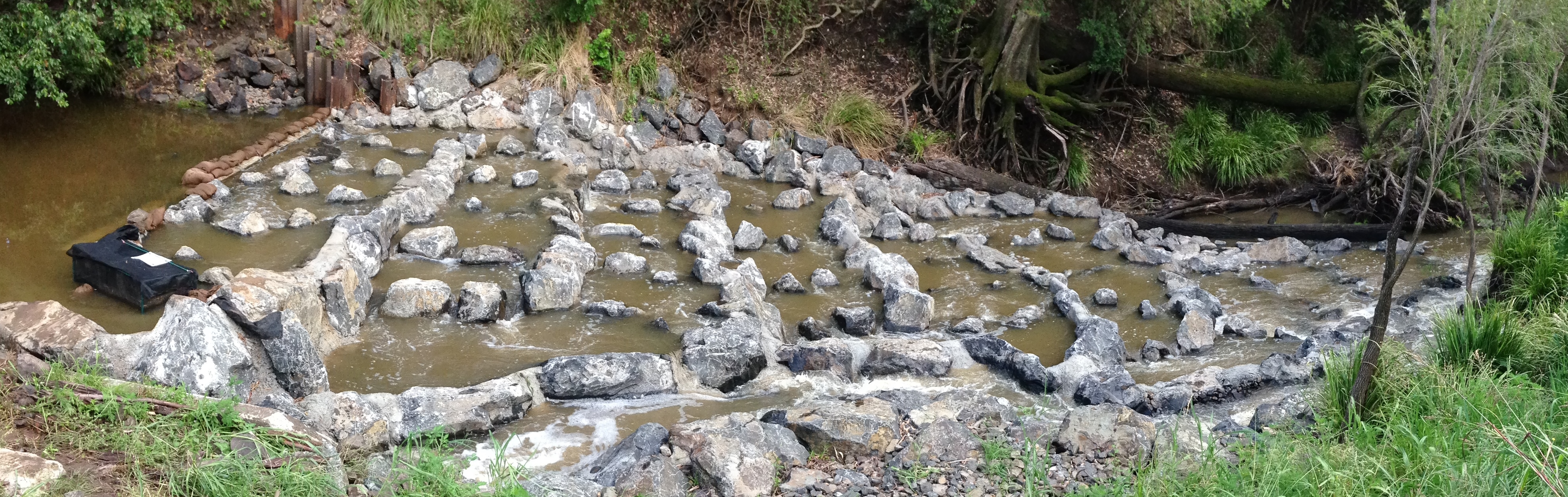
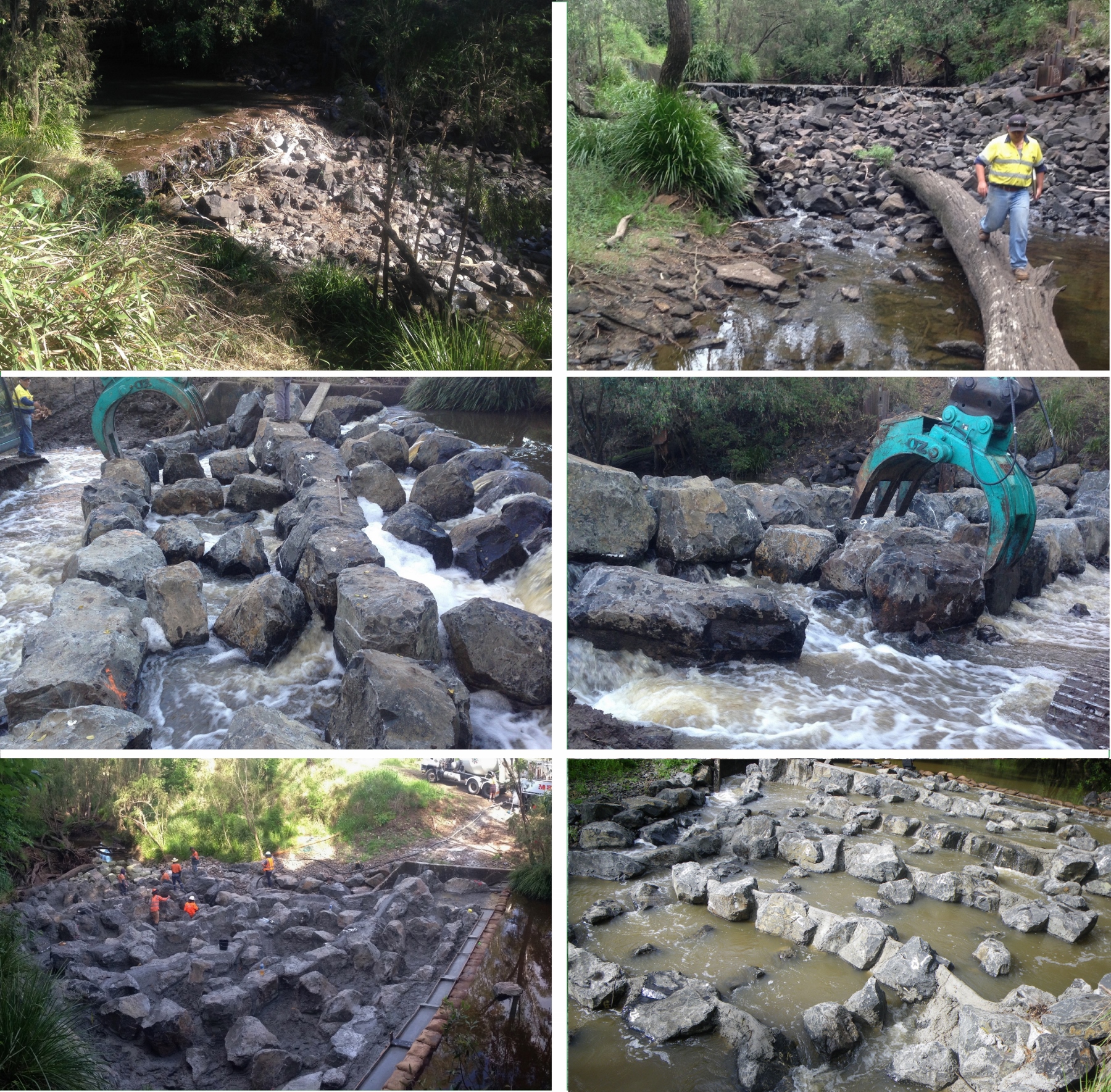
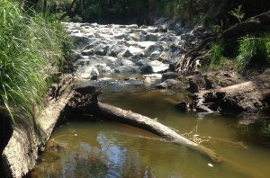
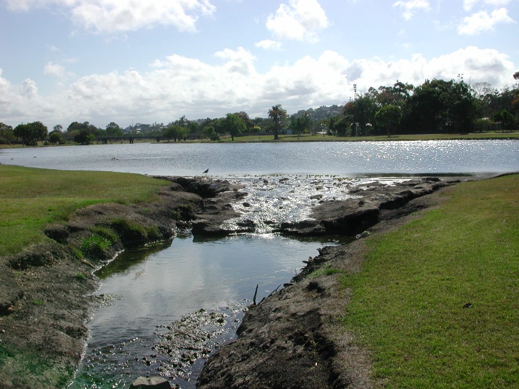
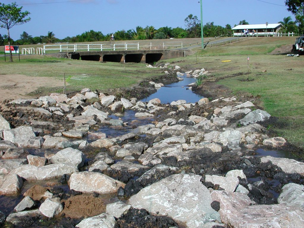
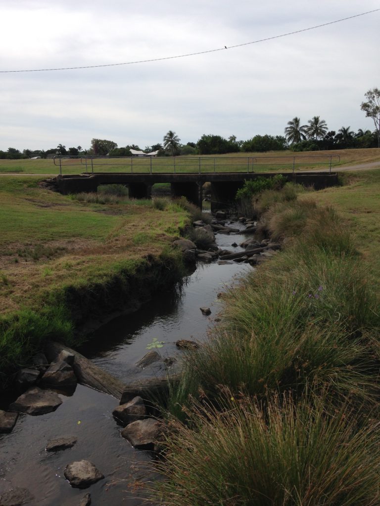
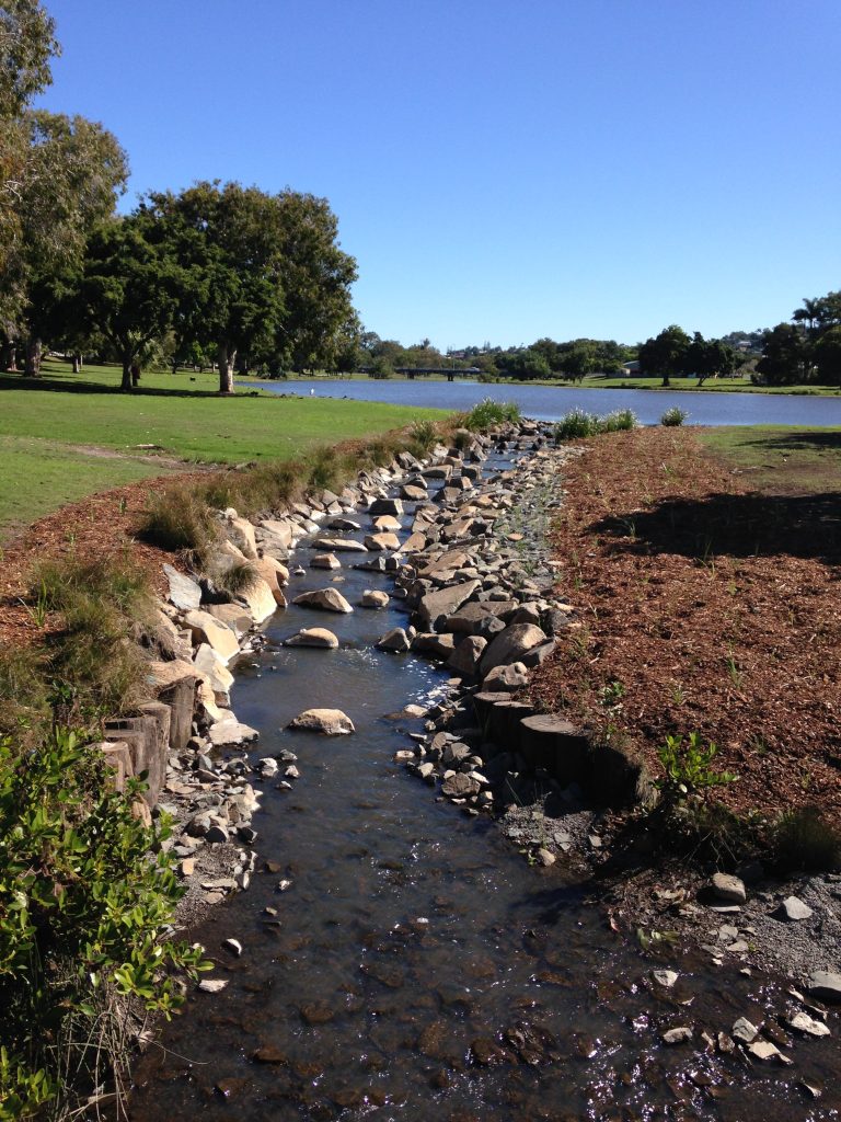
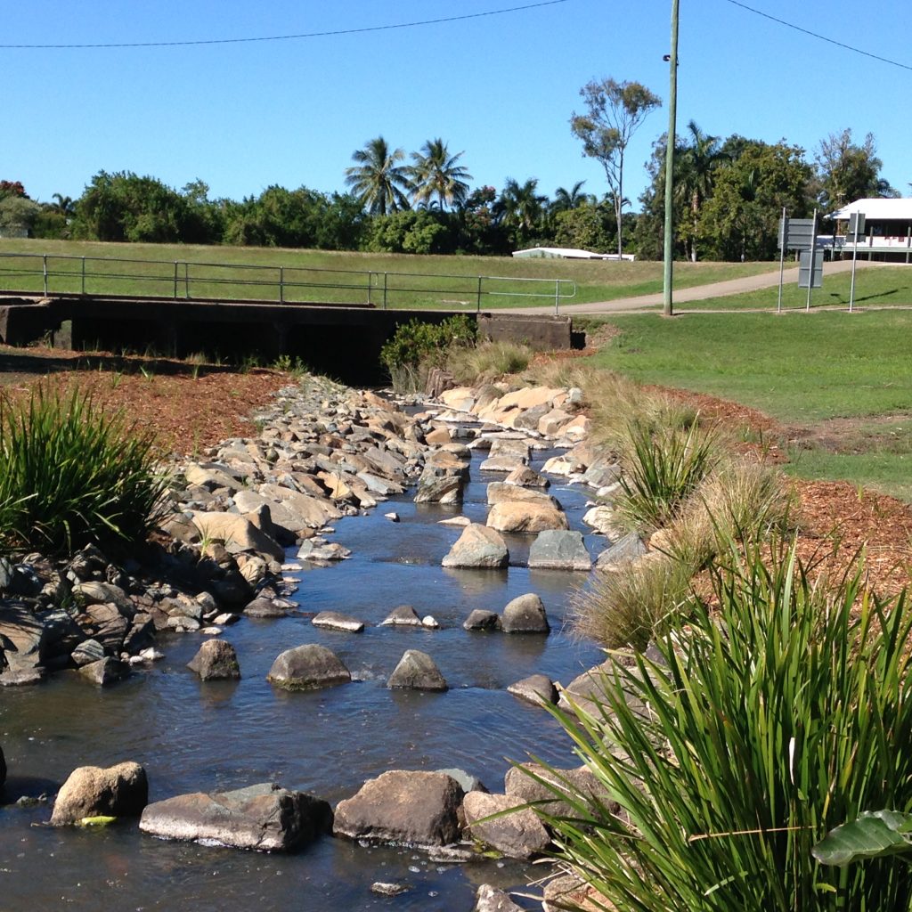
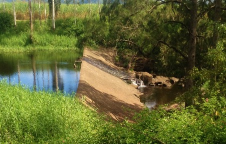
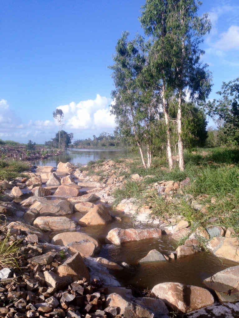
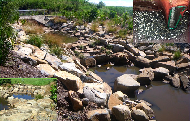
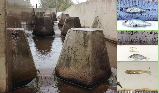
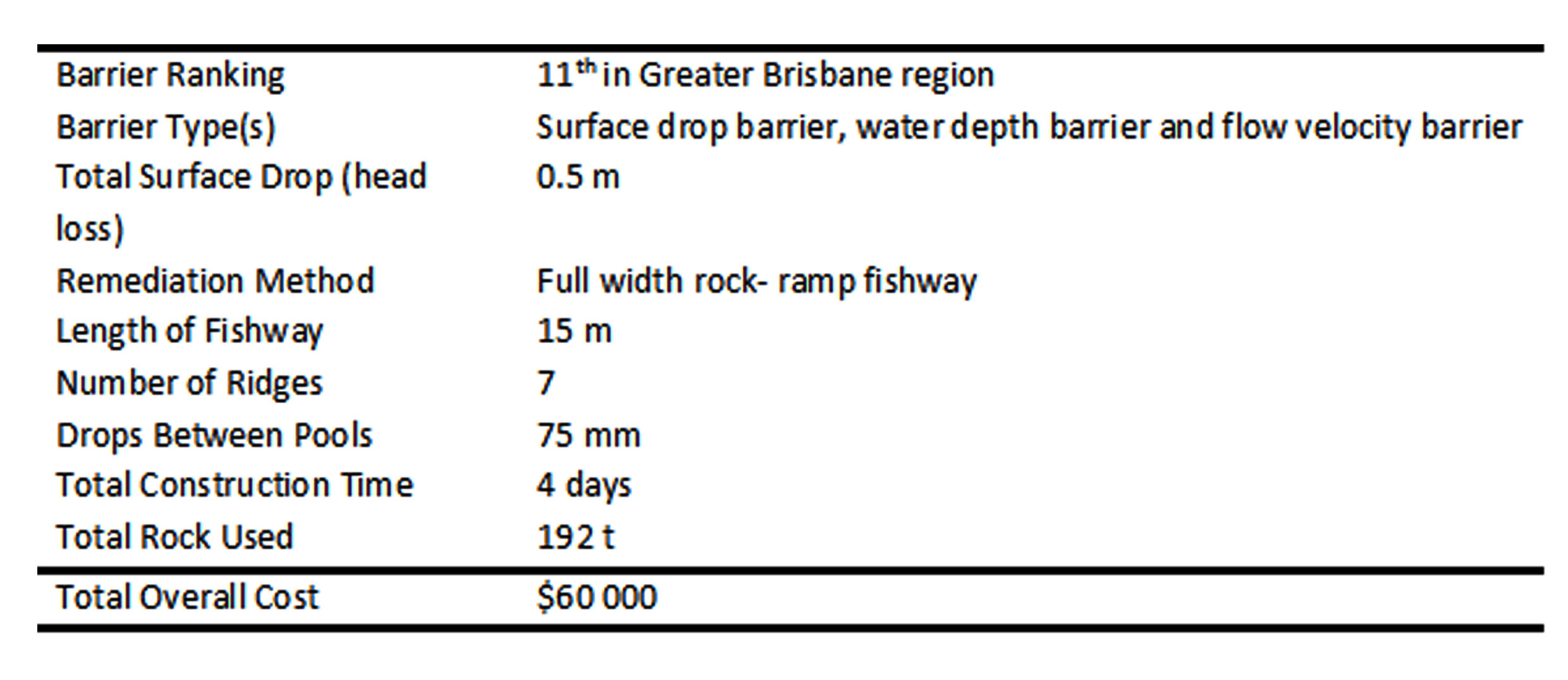
The remediation of Leitchs Crossing with a nature-like rock-ramp fishway was undertaken in partnership between Moreton Bay Regional Council and Catchment Solutions. Leitchs Crossing is located in the lower reaches of the South Pine River and was ranked as the 11th highest priority fish barrier in the greater Brisbane region. A fish passage options assessment determined that a full width rock-ramp fishway was the best fish passage remediation option for this barrier type in assisting fish to ascend past the barrier to upstream habitats.

Figure 1. Leitchs Crossing fish barrier prior to the remediation with a rock-ramp fishway.
Figure 2. Images of fish barrier during construction of the Leitchs Crossing rock-ramp fishway.

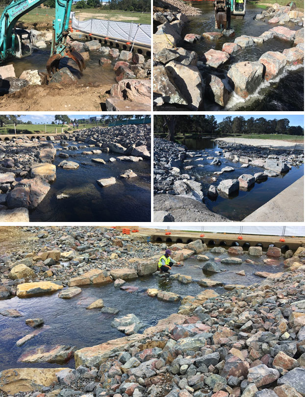
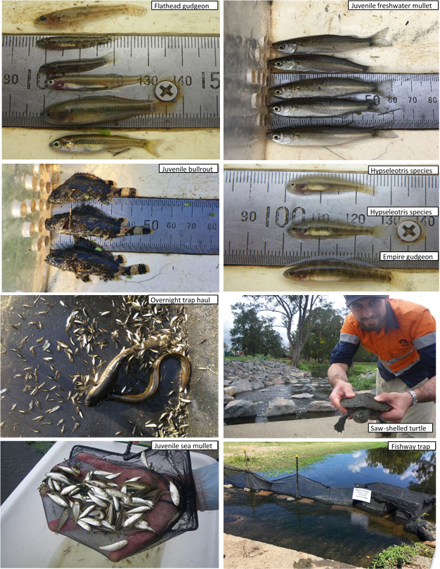
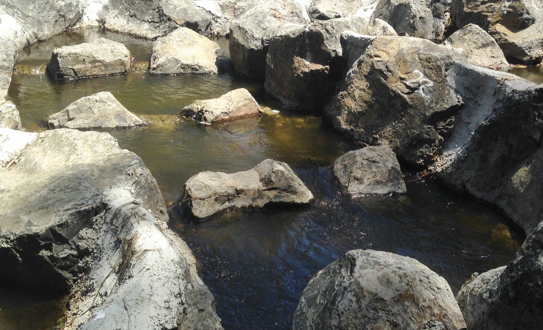
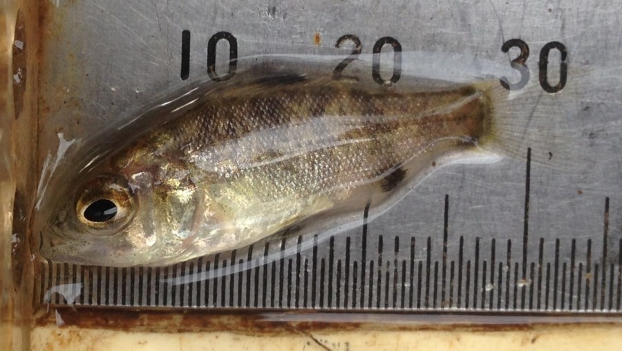
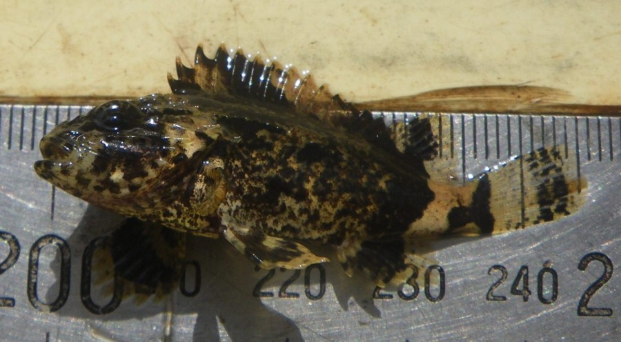
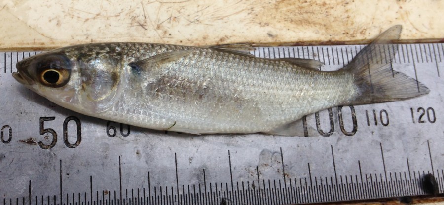
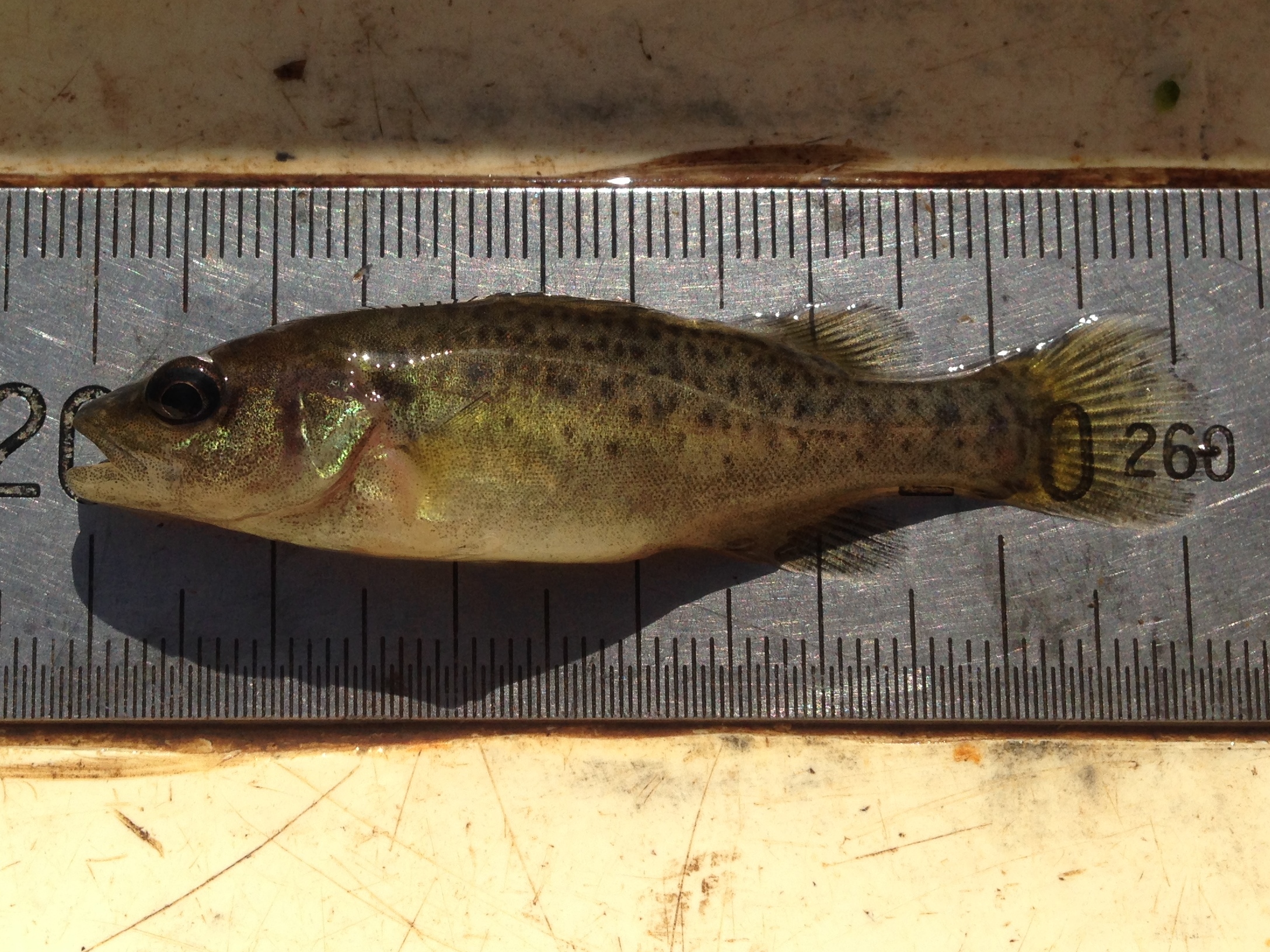
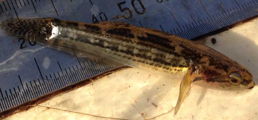
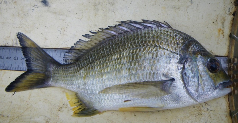
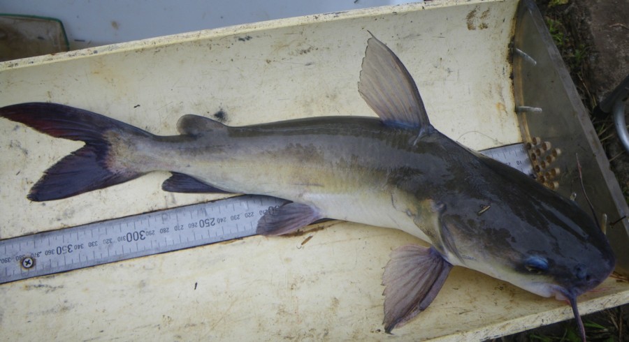
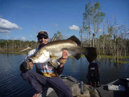
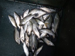
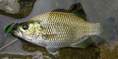
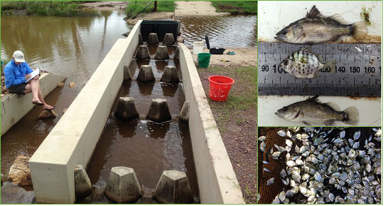
Following construction of the rock-ramp fishway at Leitchs Crossing, fishway monitoring was carried out in October 2017 to assess the capabilities of the fishway at passing the full suite of fish species and size classes expected to occur in South Pine River. The fishway trap was set at the exit of the fishway on the upstream side of the crossing, to show the numbers and species of fish that were able to ascend the fishway. Across five days of monitoring, a total of 19 species were surveyed ascending the fishway at an overall rate of 1,195.9 fish per day. Notable captures include juvenile freshwater mullet and speckled goby, both diadromous fish species that had not previously been recorded during annual EHMP fish surveys in the South Pine River (survey site located upstream of the former barrier). It is anticipated that improved connectivity as a result of the fishway will assist in the recovery of freshwater mullet and speckled goby populations in the South Pine River. Also significant was the high numbers of juvenile sea mullet; SEQ’s most important commercial inshore net fishery species, recorded at a catch rate of 209 fish per day. Similar to all fishway monitoring sites, no wild Australian bass were recorded, potentially suggesting poor and/or failed recruitment of this species.

Table 1. Catch results of fishway monitoring of the Leitchs Crossing fishway in October 2017.

Figure 3. Fish captured successfully ascending Leitchs Crossing fishway during fishway utilisation monitoring.

Fish Passage Rehabilitation in South East Queensland

diana · Sep 12, 2018 ·

For the past three years, Catchment Solutions has been part of a project that identified more than 13 000 barriers to fish passage in South East Queensland, across 14 catchments. These movement barriers include weirs, culverts, bridge crossings, walkways, roads and tidal bunds.

Barriers were prioritised in order to develop potential remediation options that would allow fish to complete their migratory life-cycles, often between estuarine and freshwater environments. A number of sites were then selected for remediation to have fish ladders or ‘fishways’ designed and constructed as part of the project to demonstrate the effectiveness of these types of structures. This video highlights the fishways and the monitoring that occurred following remediation works with outstanding results in fish passage rehabilitation.

This project was co-funded by local councils and Reef Catchments NRM through the Australian Government’s National Landcare Program. Fishway design and construction was delivered by Catchment Solutions. This video was produced by Kim Kleidon, edited by Jac Kotze.

Cane recovery after Cyclone Debbie

diana · Sep 13, 2017 ·

Landline reports ABC report

Jungle perch stretch their fins in Brendale

diana · May 30, 2017 ·

Catchment Solutions and Moreton Bay Regional Council have completed a nature like rock ramp fish ladder at Leitch’s Crossing on the South Pine River which allows economically valuable juvenile fish to move freely upstream.

Catchments Solutions fisheries biologist, Matt Moore, said the native fish were really poor swimmers and could only swim fast in small bursts which meant road crossings, causeways, weirs and culverts were major barriers.

South Pine River and a rock ramp fishway.
South Pine River rock ramp fishway.

The velocity through the pipes, and the drop of downstream at Leitch’s Crossing, prevented critical life-cycle dependant migrations upstream for decades which impacted on native fish populations.

“We’ve opened up breeding habitat for Jungle Perch and Australian Bass, both of which are popular with recreational fishers,” said Matt.

Councillor Mike Charlton said the new fishway, located on the border between Brendale and Albany Creek, was similar to a set of stairs and allowed fish to easily make their way up and down the peak of an existing culvert one step at a time.

Fish ladder at South Pine River.
South Pine River rock ramp fishway, facing upstream.

More than 400 tonne of rocks, weighing as much as 3.5 tonne each were strategically placed with a large excavator to form a series of pools interspersed with small 70 mm drops.

Catchment Solutions has completed three out of the planned five fish-ways to re-connect fish habitats
fragmented by barriers in South-east Queensland. These five were identified as the most important to need remediation out of 13,797 barriers in the region.

South Pine River rock ramp fishway.
South Pine River rock ramp Fishway, Leitchs Crossing in Brendale, Qld

The South Pine River fish ladder is a joint project between Moreton Bay Regional Council and Reef Catchments with co-funding from the Australian Government National Landcare Programme (Target Area Grant). The design and construction of the Fish Ladder on Leitchs Crossing in Brendale was overseen by environmental consultants Catchment Solutions.

Berrys Weir rock ramp fishway on the Bremer River

diana · Feb 21, 2017 ·

Background:
Construction of Berrys Weir partial width rock ramp fishway on the Bremer River in Ipswich was completed in October 2016. The fishway was constructed on a large 2.4 m high barrier (Berrys Weir), making this the longest rock ramp fishway in Australia (Figure 1).

Longest rock ramp fishway, here at Berrys Weir.
Figure 1: Bremer River rock ramp fishway.

Berrys Weir on the Bremer River was constructed in the 1960’s to impound water for power generation, forming a major barrier to fish migration (Figure 2). The weir was constructed in the lower reaches of the Bremer River, impacting crucial life-cycle dependant migrations between downstream estuarine environments and upstream freshwater habitats. The barrier impacted many native species including a number of economically important fish species, such as Australian bass, sea mullet, and long-finned eels. The Bremer River is also home to the endangered Mary River Cod, which have been re-introduced as part of conservation efforts to save their population. Barriers to fish passage are widely known to adversely impact on fish populations, so the re-opening of over 41 kilometres of riverine habitat along the Bremer River is a big step in the right direction for the recovery of this endangered species.

Berrys weir fish barrier on the Bremer River in South East Queensland.
Figure 2: From top left to right: Berrys Weir pre-fishway construction; placing large rocks to form the fishway; concreting the fishway to seal the pools, top view of the fishway in operation.

Berrys Weir was highly ranked during a recent fish barrier prioritisation project conducted by Catchment Solutions (Moore, 2016 Greater Brisbane Fish Barrier Prioritisation). The fish barrier prioritisation was funded by the Australian Government’s Target Area funding stream. The sites’ close proximity to estuarine habitats (~3 kilometres), large area of blocked upstream habitat, and large height of the barrier contributed to its high priority ranking. Through this process Berrys Weir was ranked the seventh  most important fish barrier in South-East Queensland. In collaboration with Ipswich City Council, Catchment Solutions set about remediating the lack of fish passage through the installation of a fishway.

A partial width rock ramp fishway was chosen as the most appropriate option to improve connectivity along the lower reaches of the Bremer River. Rock ramp fishways are excellent at facilitating fish passage for the whole fish community; including really small bodied fish and economically important juvenile diadromous fish species as well as adults. Rock ramp fishways are also inexpensive and have a natural appearance when compared to their highly engineered smooth sided vertical-slot fishway cousins.

The rock ramp fishway was funded by the Australian Government and Ipswich City Council, with in-kind assistance from Stanwell Power (asset owners).

Partial Width Rock Ramp Fishway Configuration

Rock ramp fish way pool and ridge.
Figure 3. Typical fishway pool and ridge configuration

The partial width rock ramp fishway extends 90 m in length in a zig-zag (dog leg) configuration, and consists of 33 ridges and pools (cells). The fishway was designed to operate at low and medium flows with a slope 1V:27H. Due to the proximity to estuarine habitats, falls (drops) between ridges and pools were set at 75 mm to cater for weaker swimming juvenile diadromous and small bodied species within the system (Figure 3). Fishway pools were approximately 2 -3 m² and ranged between 0.4 – 1 m in depth during low flows. This provided the resting areas and turbulence dissipation juvenile and small bodied species need to negotiate the large fishway. Ridges consisted of 3 slots, with each slot approximately 100- 250 mm wide and 200-400 mm high, allowing the fishway to operate over a range of flow conditions.

From our sampling, it was found that many small bodied and juvenile fish (figures 4 to 7) were able to negotiate the fishway during the low-medium flow conditions, with the median size of all fish captured just 34 mm in length (n=3514).

Juvenile Australian bass.
Juvenile Australian bass (32 mm)
Juvenile bullrout.
Juvenile bullrout (45 mm)
Juvenile sea mullet.
Juvenile sea mullet (65 mm)

In high flow situations when the fishway features drown out, the design provides a steady slope of 1V:14H from the weir crest to the downstream bed as well as the 1:27 slope of the low flow path. Although not sampled during high flows, there are reports of large adult fish (e.g. Australian bass and bullrout) migrating in SEQ streams during these conditions. It is not known whether these fish are able to negotiate the 1:14 overall slope, or track the 1:27 slope of the low flow path. However, given that the existing conditions at this site had an overall slope of 1V:9H with a 1 – 1.2 m vertical drop abutting the weir crest, it is anticipated that the fishway has greatly improved fish passage past the weir in high flows.

Juvenile Mary River Cod, which are endangered.
Figure 7. Juvenile endangered Mary River cod (62 mm)

Construction of the fishway involved a 21 t excavator fitted with a hydraulic rock grab. The grab was used to place the 400 t of large igneous rock between 1 – 2.5 m and weighing up to 5 tonnes into specific positions to from the ridges and side walls. 32 m³ of fibre reinforced concrete was pumped into position to seal fishway pools and set fishway ridge controls to design levels. A 100 mm high concrete nib wall was constructed on top of the existing weir to divert low flows through the fishway.

Fishway Monitoring Results

Fishway trap monitoring was successfully undertaken across five days in mid-December 2016. For the majority of the sampling period low flow conditions were present, on days four and five flows elevated to moderate as a result of local storm inflows. This provided an opportunity to observe fish movement over changing conditions.

Fishway monitoring results demonstrate that the fishway is operating successfully, with 3514 individual fish representing 21 species (19 native and 2 introduced species) sampled. A catch rate of 690.4 fish/day was recorded across the duration of monitoring. Significantly, native fish represented 99.94% of the catch, with only two alien fish representing two species (platy and tilapia) recorded. Hypseleotris species (unable to be positively identified in the field – specimens sent to the Qld Museum for correct identification which revealed both H. galii and H. klunzingeri) were the most abundant species representing 36.1% of the catch, followed by crimson-spotted rainbowfish, empire gudgeon, striped gudgeon and sea mullet with 25.7%, 16.5%, 11.6% and 5.7% respectively.

The smallest fish species recorded successfully ascending the fishway included a 15 mm Hypseleotris species, followed by crimson-spotted rainbowfish, empire gudgeon, flathead gudgeon and striped gudgeon (Figure 8) at 18 mm, 19 mm, 20 mm and 21 mm respectively. The largest fish species recorded included a 550 mm long-fin eel, followed by fork-tailed catfish (Figure 10), yellow-fin bream and bony bream at 350 mm, 254 mm and 254 mm respectively. The median size of all fish captured successfully migrating through the fishway equated to just 34 mm.

Diadromous species represented 32% of the total species captured, and 36% of total individuals. The smallest size diadromous species included; empire gudgeon 19 mm, striped gudgeon 21 mm, Australian bass 30 mm, bullrout 35 mm, sea mullet 38 mm, long-finned eel 70 mm and yellow-fin bream 254 mm (Figure 9). The median size of diadromous species included; empire gudgeon 35 mm, striped gudgeon 35 mm, Australian bass 35 mm, bullrout 54 mm, sea mullet 65 mm, long-finned eel 255 mm and yellow-fin bream 254 mm.

Striped gudgeon.
Striped gudgeon.
Yellow-fin bream.
Yellow-fin bream.
Forked-tail catfish.
Bremer River Forked-tail catfish.

All fish species recorded successfully migrating through the fishway had to negotiate at least 1.5 m/sec through the ridge slot (low flow conditions), with many fish species migrating through minimum velocities up to 2.1 m/sec (moderate flow conditions).

Interestingly the median size of fish increased with the rise in river flow. During low flow conditions experienced between the afternoon of 15th December until mid-day on the 18th, the median size of fish moving through the fishway equated to 33 mm. A storm event on the afternoon of the 18th caused the river to rise rapidly, during this elevated flow period the median size of fish more than tripled to 110 mm. On the recession of this flow event (19th & 20th) smaller fish began to be more prevalent in captures with a median size of 55 mm. While only anecdotal, these results support the theory that larger fish move during elevated river flows, while juvenile and small bodied species migrate across all flow events, with a preference for low and receding flow conditions to undertake movement (Figure 11).

Figure 11. Showing median fish length (mm) plotted against stream height (m). Open circles represent median fish size and error bars the 10th and 90th percentile.
Full width rock ramp fishway entrance.
Figure 12. Fishway entrance.


For more information relating to the Berrys Weir fishway or other fishway projects underway in Queensland, please contact Catchment Solutions on (07) 4968 4200.

A fishway in photos: Mackay Gooseponds Fishway Repair

diana · Oct 4, 2016 ·

Fishways are essential in improving connectivity and building a more sustainable and healthy native fish population.

Fish migration is essential, particularly for important diadromous (migratory) species such as; barramundi, mangrove jack, giant herring, tarpon, jungle perch and Australian bass. All these fish species breed in estuarine or marine environments, before their off-spring migrate into freshwater rivers and wetlands to feed, grow and evade predators.

Often, there are barriers to fish attempting to migrate and this can significantly impact our native fish population. For example, any barrier restricting or preventing barramundi from reaching important nursery grounds is going to have an impact on barramundi numbers into the future.

If the barrier cannot be removed, to overcome this an appropriately designed fish ladder (fishway) is the best rehabilitation strategy.

Here, we look at a fishway in photos to help showcase the elements involved.
The fishway at the lower end of the Gooseponds in Mackay was built in 2000 and has helped support fish passage for important species for many years. Over the last decade there have been many improvements in fishway design that increase functionality and service life, and make them more aesthetically pleasing. When funding became available to do some repair work to this fishway, new design elements were built in. As you can see the results speak for themselves.

Funding was provided by Reef Catchments in partnership with Mackay Regional Council. Design and on-ground works were undertaken by Catchment Solutions.

Read more about fish ladders here: https://www.catchmentsolutions.com.au/fisheries-aquatic-ecosystems/

Fishway at the Gooseponds.
The original barrier prior to fishway installation
Rock ramp.
After the construction of a rock ramp/notched log fish. Note the early designs did not incorporate bank stabilisation and revegetation.
Fishway.
The fishway earlier this year, erosion of the bed and banks had caused some ridges to slump.
Repaired fishway.
In June 2016 repair work restored the ridges, incorporated bank stabilisation and included revegetation of the banks
Large boulders in fishway.
The use of large natural boulders and strategic riparian revegetation are not only aesthetically pleasing but also improve bank stability.

From little fish big fish grow…

diana · Oct 4, 2016 ·

Trent Power from Catchment Solutions with a very big fish.
Trent Power displays a good-sized barra. One of Queensland’s most high profile species, barramundi are among a wide range of our native fish feeling the impact of fish barriers.

It sounds obvious, but it’s a feat of nature few of us witness – small fish need time, uninterrupted access to our waterways and a whole lot of good quality habitat to become the big catch that sends tingles through an angler’s spine.

In the quiet of the creeks and rivers, if there’s something getting in the way as our juveniles struggle to the next stage of their life, the inevitable result? Far less good sized, healthy fish in our future.

It’s the equivalent of an underwater horror show for keen fishers – the idea that the next generation will have access to a significantly reduced pool of fish stock and diversity. Who wants to sit in a river mouth ten years from now reflecting on the kind of fish you used to be able to catch?

Now is the time to give it some consideration, according to the latest research. A recent report by Queensland based environmental consultants has identified thousands of potential barriers stopping our native fish in their tracks. Both manmade and natural, these barriers are interfering with our native fishes’ ability to manoeuvre through vital water courses to complete their life cycle. It’s a particularly pertinent issue for diadromous (migratory) species who need to transition from salt to freshwater over the years.

We’re talking some big name breeds – depending on your location, barra, mangrove jack, sleepy cod, jungle perch, tarpon, Australian bass, sea mullet, long and short-finned eels to name a few.

Fish catch.Depleting our waterway health also increases the likelihood of a slow invasion by pest fish who are less sensitive than our natives and who thrive in poor conditions – for example the notorious tilapia, cane toad of the water.

The fish barrier report identified 13,000 potential fish barriers in South East Queensland alone, just the tip of the iceberg. Another report in the Mackay Whitsunday region uncovered 3974 potential in-stream barriers.

While it’s not possible to tackle every barrier, these reports also ranked barriers in order of priority, marking out the top trouble spots to focus on. Here, we introduce you to what fish barriers are and why they matter.

Keep an eye out for part two in this series, which will look at the design and construction of fishways and how we can overcome fish barriers moving forward.

Weir on a river.
Fish barrier

What kinds of fish are being held back by fish barriers?

In particular, diadromous (migratory) species which need to transition between waterways, including salt and freshwater, to complete their life cycle. As previously mentioned, that includes key species like barramundi, mangrove jack, sleepy cod, jungle perch, tarpon, Australian bass, sea mullet and long and short-finned eels.

Many of these much-loved fish species require unimpeded access between freshwater and estuarine habitats to maintain sustainable populations.

If we’re talking scientific terms you can break it down again to:

Diadromous – Diadromous fishes are truly migratory species and whose distinctive characteristics
include that they:
Migrate between freshwaters and the sea;
The movement is usually obligatory; and
Migration takes place at fixed seasons or life stages.
There are three distinctions within the diadromous category:
Catadromous – Diadromous fishes that spend most of their lives in fresh water, and
migrate to sea to breed.
Amphidromous – Diadromous fishes in which migration between freshwater and the sea is
not for the purpose of breeding, but occurs at some other stage of the life cycle.
Anadromous – Diadromous fishes that spend most of their lives at sea, and migrate to
freshwater to breed.
Migrations can vary – some are short and confined wholly to freshwater habitats, while other migrations occur across vast distances and between varying habitats, including between freshwater and near-shore marine environments.

Fish.Our native fish can’t jump

Forget the famous images of Atlantic salmon leaping upstream in Canada – our juvenile native fish aren’t even remotely in the same boat. Australian native species are easily knocked back by velocity and brought to a halt by even minor barriers. Historically, Australian waterways have been accessible and they rely on a smooth and comfortable passage between salt and freshwater.

Why they need clear passage

Migration is an essential life history adaptation for many native fish species. Migration strategies between key habitats have evolved for a variety of reasons, including for feeding and reproduction purposes, to avoid predators, remove parasites, to utilise nursery areas and maintain genetic diversity.

Exactly what are fish barriers?

Put simply, fish barriers (natural or manmade) are any barrier deemed to prevent, delay or obstruct fish migration.
Natural barriers can include weed chokes, waterfalls, low dissolved oxygen slugs and high water temperature. Manmade barriers however are more common.

Culprits include culverts, pipes, road crossings, weirs, dams, flow gauging structures, bunds (or ponded pastures) and sand dams.
These structures can be built for a variety of purposes like irrigation supply, flow gauging and regulation, urban and industrial development, road crossings or simply urban beautification and recreation facilities.

How do they affect our fish?

Barriers impact fish communities in many ways. Some barriers such as high dams form complete blockages. Other structures like culverts present partial or temporary barriers, restricting fish movement during particular flow events. Even small vertical drops downstream of road crossings and culvert aprons are enough to form barriers for many fish, particularly juvenile and small bodied species.

How can we get past them?

Manmade barriers are a great target for intervention and remediation works like fishways, which are increasingly seen as the way forward to sustain our native stocks into the future – more on this to come in part two!
Information taken from the: Mackay Whitsunday Fish Barrier Prioritisation Report and the Greater Brisbane Urban Fish Barrier Prioritatisation Report. For more information contact Matt Moore, info@catchmentsolutions.com or www.reefcatchments.wpengine.com/cs/resources

This train is a treat

diana · Sep 28, 2016 ·

Wetland ‘treatment train’ improves water quality and runoff from agricultural land

Catchment Solutions, in collaboration with Reef Catchments NRM and Mackay cane farmer Shane Cowley have created a treatment train of wetlands to treat poor water quality runoff from adjacent sugar cane farms reaching the Great Barrier Reef (GBR) in the Bakers Creek Catchment, Mackay in central QLD.

 Aerial drone footage showing the Treatment Train. 

Treatment train rock ramp fishway at Bakers Creek.The project took an holistic approach to wetland design, by treating water quality flowing to the GBR while also providing and enhancing habitat for biodiversity.

This was achieved by constructing four water quality treatment chambers – sediment basin, deep water macrophyte zone, detention irrigation re-use chamber and rehabilitating the existing wetland (last chamber). Endemic native vegetation was planted around the wetland, including macrophytes in the deep marsh zone. A rock-ramp fish ladder was also constructed to improve aquatic connectivity between the downstream estuary and the constructed wetland, which provides important habitat for economically important fish species such as barramundi.

The wetland was designed to capture and treat the first flush flow event (30-40 mm) of the wet season (Oct-Dec), prior to discharging into an existing wetland before eventually flowing into Bakers Creek Estuary and the GBR.

The landholder (cane farmer) is able to re-use the water from the third chamber to irrigate his sugar cane crop. Prior to the construction of the upstream treatment chambers, water high in nutrients,herbicides and pesticides flowed straight into the wetland causing fish kills.This water was then pumped right down for irrigation re-use onto adjacent sugar cane. Now, this wetland is managed for biodiversity, with the water treated in upstream chambers and no pumping down of the biodiversity wetland.

Water quality sampling was undertaken during flow events via auto samplers. The results have been significant, delivering both environmental improvement, as well as allowing the cane farmer access to increased irrigation capacity. Fish ladder monitoring and fish community electrofishing have also occurred.

“This extra water means that I can irrigate nearby cane blocks several more times each year and significantly increase their production, as well as improving the water quality for my wetland and the Great Barrier Reef lagoon.”
– Shane Cowley, Cane Farmer, Bakers Creek.

Results (snap shot)

Event 1 (30-40 mm) Dec 2014
NOx-N – 85% reduction
Phosphorus (total and ortho-P) – 50% reduction
Diuron – 59% reduction
Atrazine – 61% reduction
Hexazinone – 55 % reduction

Between last flow event in Feb 2015 to October 2015

86% reduction of N
90% for P
80% for TSS

Map Bakers Creek treatment train.     Reeds in creek at the Bakers Creek treatment train.   Treatment train creeks at Bakers Creek.


Queensland’s longest fish ladder at Ipswich

diana · Aug 23, 2016 ·

Matt Moore from Catchment Solutions in Mackay on a riverbed with rocks.
Photo credit: John Armstrong, Lifestyle Qld

August 3 saw the construction of Queensland’s longest ‘fish ladder’ in Ipswich.

Over 80 metres long, 2.4 metres high and with 35 steps and pools – once completed the ladder will give important native fish species easy access to their upstream homes for the first time in more than fifty years.

The project sees Ipswich City Council leading the charge in improving fish population and waterway health in South East Queensland.

The structure is being delivered in tandem with environmental consultants and fish ecology specialists, Catchment Solutions, alongside Reef Catchments and Stanwell Corporation Limited.

Rock ladder.“This is a huge step up, so to speak, for our native fish in the Bremer river area. There are numerous fish ladders in Queensland but none as long as 80 metres,” said Matt Moore, fisheries biologist with Catchment Solutions in Mackay.

“Fish populations upstream of Berry’s Weir have declined significantly due to restricted fish passage and movement through the water since the weir was built in the 60s. For example, we know while you can catch Australian Bass downstream below the weir, people have stopped catching them upstream.”

The weir is 2.4 metres high posing an insurmountable challenge for all juvenile and adult native fish, particularly diadromous (migratory) species, which need to swim upstream from the sea to freshwater habitats to complete their lifecycle, before returning as fully grown adults to spawn.

“It’s a rite of passage for fish and without this full cycle, what we will see is significantly reduced populations of important recreational and commercial native fish species like Australian bass, sea mullet and long and short-finned eels. That’s a problem for waterway health, fish diversity, and recreational fishing,” Mr Moore said.
“What the ladder does is provide a series of steps and pools in a natural rock formation that allow the fish to easily ascend over the barrier (in this case the weir) by swimming, stopping for a rest, and swimming again.”

Matt Moore at the Bremer River rock way.Ipswich Mayor Paul Pisasale said council was committed to helping improve local waterways.

“The challenges we face today in improving our local waterways did not come about overnight, and as such it will take several years to meet them,” he said.

“Council is committed to balancing environmental needs alongside our city’s on-going growth and making sure sustainability is front and centre for all that we do.

“This fish ladder is an important piece of infrastructure that will directly improve conditions for fish in the Bremer River and is a part of council’s strategy of focusing heavily on actions that will directly improve waterway health.”

Mr Moore said the Bremer River had been identified in a recent report as one of the key priority areas for removal of fish barriers.

“Report findings identified over 13,000 potential barriers to fish passage in the South East Queensland area. Berry’s Weir in the Bremer River was listed in the top ten target fish barrier sites, coming in at number seven as one of the most important sites to improve fish passage.

“I’d like to extend a huge congratulations to Ipswich City Council for recognising and investing in the restoration of fish passage to improve waterway and aquatic ecosystem health.
“Likewise, works could not have gone ahead with the support and cooperation of Stanwell, which own the weir, and have played an integral part in this process. This is an excellent example of true collaboration and the sustainability outcomes that can be achieved.”

It is hoped the fish ladder will also help improve the Bremer Catchment’s overall waterway health score, which was listed as a D- in the latest Healthy Waterways Report Card.


Fish hotels are hot real estate for Mackay

diana · Aug 23, 2016 ·

People in front of a Mackay fish hotel.There’s one area in town that’s not been hit hard by a real estate downturn – and it’s underwater.

For the first time, there are fish hotels in Mackay. It’s good news for targeted tenants, including barramundi, mangrove jack and sleepy cod, to name a few.

Catchment Solutions aquatic ecologist, Trent Power, said the installation of ten fish hotels in two priority sites at the Mackay Gooseponds on 27 June was exciting news – “We’re looking to attract a variety of fish to our new ‘real estate’ by creating the kind of habitat they love to live in,” Mr Power said.

“It is important to cater for the different habitat preference of our native fish. Currently in the Gooseponds there are ample weeded areas, rock walls, open water and muddy banks, but virtually no snags.

“The fish hotels will help increase the habitat for the fish species that prefer these areas, particularly predatory species, like barramundi, sleepy cod and mangrove jack.

“We will be catering to a diverse crowd – smaller fish are able to hide away in the nooks and crannies, while large predatory fish can wait in the shadows. By increasing habitat availability, our native fish communities can become more resilient and are better able to cope with threats, like the pest fish Tilapia.”

Fish hotels are engineered wooden structures, built to emulate what naturally occurs in rivers and streams when trees fall into the waterway (snags/woody debris). Unfortunately, in areas that have been cleared or developed, this natural process is interrupted. The hotels create spaces that provide habitat, refuge and a living and breeding area for important fish species. Fish hotels provide additional level of complexity to the habitats available for native fish and other aquatic fauna.

The fish hotel project is proudly supported by Reef Catchments in collaboration with Rio Tinto, through funding from the Hail Creek Mine Community Development Fund and the Australian Government. The hotels were designed and delivered by environmental consultants, Catchment Solutions.

Crane with fish hotel in Mackay.The project is strongly supported by in-kind partners including Mackay Regional Council, Mackay Recreational Fishers Alliance Inc, and the Mackay Area Fish Stocking Association.

Hail Creek Mine’s general manager – operations, Rowan Munro said, “We are proud to support this important project to help improve the water quality and habitat for native fish and other aquatic species in the Gooseponds Wetlands area. The Hail Creek Mine Community Development Fund continues to provide opportunities for local projects to deliver real benefits and we look forward to seeing a stronger, healthier ecosystem in the Gooseponds wetlands that community members can treasure into the future.”

Mackay Regional Councillor and Economic Development and Planning Committee member, Fran Fordham, said the installation of log hotels at the Gooseponds would help build the resilience of native and iconic fish species such as barramundi.

“Juvenile barramundi willingly move into these freshwater environments, via fishways, from the estuary and use this environment as a nursery habitat before returning to estuaries as sub-adults,” she said. “Creating favourable habitats for these higher order predators will give them a better chance at competing with exotic, invasive fish species such as tilapia.”

Fish hotel installation follows a comprehensive feasibility study, including flood modelling.

“Flood modelling was completed using the existing Gooseponds Catchment model as well as data provided by the Department of Natural Resources and concept designs,” Cr Fordham said. “This was done to ensure this project would not adversely impact the intensity or duration of flooding during high flow events. The results demonstrated that the log hotels would have an insignificant impact on flood conditions during 1 in 5 and 1 in 100 year flood event.”


Mr Power said ultimately, he had high hopes the fish hotel chain could be expanded throughout local waterways. “Our initial studies indicated four priority sites for fish hotel construction, but so far we have only secured funding for two – however, we have high hopes the hotels will expand in the future!” he said.

“They can be installed anywhere there is the need for aquatic habitat, including in urban and rural areas, in constructed wetlands and on private landholder property.”

Mackay Recreational Fishers Alliance Inc spokesperson, Lance Murray, said fish hotels were a strong step forward for the Mackay area. “Habitat protection and water quality are two essential ingredients of fish recruitment and sustainability, this initiative is a good step in the right direction,” he said.

CHANNEL 7 NEWS https://www.facebook.com/ReefCatchments/posts/1073790236024063

People in front of fish hotels in Mackay.


Mackay Whitsundays Fishways Monitoring Results (2016)

diana · May 10, 2016 ·

Recent fishway monitoring across the 2015/16 wet season has revealed some interesting results with a high abundance and diversity of juvenile fish species recorded successfully ascending the regions fishways (Figure 1). Fishway trap monitoring was undertaken on Lagoons and Fursden creeks within the Pioneer River Catchment (Mackay) and on Boundary and Tedlands creeks in the Rocky Dam Creek Catchment (Koumala).

Fishway assessment revealed large numbers of fish, with up to 5764 fish successfully ascending the Lagoons Creek full width rock ramp and culvert baffle fishway (Table 1) in just under one day (21.45 hours) and 3863 fish ascending the Boundary Creek partial width concrete cone fishway (Figure 3) in just over one day (28.5 hours (Table 2)). Tedlands Creek partial width rock ramp fishway (Figure 5) in Koumala recorded 2454 in 24 hours (Table 4) and Fursden Creek full width rock ramp fishway (Figure 4) recorded 2407 fish in 26 hour period (Table 3).

Significantly, the large numbers of fish migrating through Lagoons Creek full width rock ramp (Figure 2) and culvert baffle fishway (5764 in 21.45 hrs) were higher than fish numbers recorded migrating through vertical slot fishways on Australia’s two largest rivers, the Murray River (maximum 4415 fish per day) in Victoria (Stuart et al. 2008a) and Fitzroy River (maximum 3317 fish per day) in Queensland (Stuart et al. 2007). These recent fishway sampling results highlight the importance of facilitating fish passage in small ordered waterways for maintaining fish populations in the Mackay/Whitsunday region.

Based on the ‘river continuum concept’ whereby large ordered rivers such as the Murray and Fitzroy rivers contain a greater amount of energy sources and habitats types than low ordered short coastal streams like Lagoons Creek (Strahler stream order 1), and therefore should contain a higher diversity and biomass of fish species. You would therefore expect there to be a higher number of fish migrating through these larger river systems compared to small ordered streams (1-3). However, these latest fishway monitoring results suggest this may not always be the case.

Concrete cone fishway with barramundi and banded scat.
Figure 1. Clockwise from left: Boundary Creek concrete cone fishway, juvenile barramundi (top & bottom) banded scat (middle), Boundary Creek fishway trap full of banded scats and barramundi.

These results raise several questions:

  1. Why do these fishways on small ordered waterways pass comparable, and in the case of Lagoons Creek, greater numbers of fish than fishways on the two largest river systems in Australia?
  2. Are fish, particularly small bodied and juvenile fish species purposely selecting small ordered waterways to undertake upstream migrations – as these waterways potentially offer refuge habitats with less apex aquatic predators than larger rivers, and therefore offer fish a greater chance of evading predators and reaching sexual maturity?
  3. Or do smooth- sided vertical slot fishways (≥97 mm head difference between cells) provide adverse swimming conditions for some small bodied and juvenile fish species?

Recently constructed fishways in the Mackay Whitsunday region were designed with deep pools and small drops between ridges (57 mm for the smooth sided concrete cone fishway, and 80-90 mm for the rough finish rock ramp fishways) to reduce turbulence and provide conditions suitable for juvenile and small bodied fish species, such as empire gudgeon. In Queensland, juvenile empire gudgeon undertake a mass migration from estuarine environments to upstream freshwater wetland habitats during the summer wet season (Dec-April), and were recorded successfully ascending all four fishways. These fish can be very small (12 mm), and possess weak swimming abilities, so smooth sided fishways with large drops between pools (i.e. vertical slot fishways constructed in QLD pre 2010) may create adverse conditions for this species to successfully migrate through.

Other interesting fishway monitoring results included the capture of juvenile barramundi, as small as 43 mm (average 57 mm), migrating through the Boundary Creek concrete cone fishway. These are some of the smallest barramundi ever recorded successfully migrating through fishways in Australia. The smallest was a 38 mm barramundi successfully ascending a partial width rock ramp fishway on Alligator Creek, a short coastal 5th ordered Strahler stream 20 km’s south of Townsville (Moore & Marsden 2013).

The small size of juvenile barramundi migrating through the Boundary Creek fishway (in just 3.5 days of sampling) when compared to the Fitzroy River Barrage vertical slot fishway is significant. Stuart and Mallen-Cooper (1999) monitored the vertical slot fishway on the Fitzroy River (38 paired samples (24 hr) – top and bottom) across 16 months and only recorded barramundi >200 mm successfully ascending to the top of the fishway. The average size of barramundi recorded migrating through the Boundary Creek concrete cone fishway was 57 mm (n=19). The Boundary Creek fishway (Figure 1) comprises a head difference of 53 mm between cells and is located on a Strahler stream order (SSO) 3, while the Fitzroy River comprises 97 mm head difference between cells and is situated on a SSO 9.

This again raises further important questions:

  1. Are small juvenile barramundi (< 200 mm) purposely targeting small ordered streams to migrate upstream into wetland habitats i.e. Boundary Creek (SSO 3) and not the Fitzroy River main channel (SSO 9)?
  2. Or, do vertical slot fishways with a ≥97 mm head difference between cells produce characteristics that prevent small juvenile barramundi (< 200 mm) from successfully ascending to the top of the fishway?
  3. Or is it the attracting flows and/or the fishway entrance design that prevents small juvenile barramundi (< 200 mm) from locating fishways in large rivers?

Table 1. Lagoons Creek fishway monitoring results


Lagoons Creek Fishway Monitoring  8-9th Feb 2016

Common NameSpecies NameFishery ClassificationMigration ClassificationAbundanceCPUE (Fish/Day)Size Range (mm)
TarponMegalops cyprinoidesC,R,Idiadromous10.5350
Fork-tail catfishArius graffeiR,Idiadromous10.5345.0
Empire GudgeonHypseleotris compressaAdiadromous14174.2
Bony BreamNematalosa erebiIpotamodromous1459767.932 – 68
Agassiz’s GlassfishAmbassis agassiziiApotamodromous916482.1
Eastern rainbowfishMelanotaenia splendidaApotamodromous2714.228 – 39
Fly-specked HardyheadCraterocephalus stercus.Apotamodromous73.7
Rendahl’s catfishPorochilus rendahliA,Ipotamodromous21.1126 – 161
Hyrtl’s TandanNeosilurus hyrtliiA,Ipotamodromous10.5145.0
Mosquitofish*Gambusia holbrookiPFpotamodromous34481814.7
Guppy*Poecilia reticulataPFpotamodromous10.5
11 speciesTotal60043160
C = Commercial, R = Recreational, I = Indigenous, A = Aquarium, PF = Pest Fish*
Rock ramp fishway.
Figure 2. Lagoons Creek rock ramp fishway downstream of culverts (main), fishway trap full of fish (top right) and rock ramp fishway upstream of culverts (bottom left).

Table 2. Boundary Creek concrete cone fishway monitoring results


Boundary Creek Fishway Monitoring  22-26th Feb 2016

Common NameSpecies NameFishery ClassificationMigration ClassificationAbundanceCPUE (Fish/Day)Size Range (mm)
BarramundiLates calcariferC, R, I, Adiadromous195.443 – 73
Giant HerringElops hawaiensisC, R, Idiadromous20.624
Greenback MulletLiza subviridisC, R, Idiadromous82.366 – 173
Banded ScatSelenotoca multifasciataI, Adiadromous2544724.821 – 52
Crescent PerchTerapon jarbuaR, I, Adiadromous51.435 – 45
Threadfin silverbiddyGerres filamentosusI, Adiadromous622177.221 – 42
Empire GudgeonHypseleotris compressaAdiadromous1193339.912 – 77
Spangled PerchLeipotherapon unicolorR, I, Apotamodromous10.3124
Eastern rainbowfishMelanotaenia splendidaApotamodromous51.420 – 30
9 speciesTotal43991253
C = Commercial, R = Recreational, I = Indigenous, A = Aquarium, PF = Pest Fish
Concrete cone fishway.
Figure 3. Looking upstream within the Boundary Creek concrete cone fishway (Main), inset from top to bottom (fish sampled in fishway trap): juvenile barramundi (43 mm (top) and 51 mm (bottom), juvenile empire gudgeon and threadfin silverbiddy, juvenile giant herring.


Fursden Creek Fishway Monitoring  19-22 Jan & 10-12, 22-23rd Feb 2016
Common NameSpecies NameFishery ClassificationMigration ClassificationAbundanceCPUE (Fish/Day)Size Range (mm)
BarramundiLates calcariferC, R, Idiadromous20.420
Long-finned eelAnguilla reinhardtiiC, R, Idiadromous183.745 – 700
Sea MulletMugil cephalusC, R, Idiadromous10.264
Fork-tail catfishArius graffeiR, Idiadromous112.391 – 368
TarponMegalops cyprinoidesR, Idiadromous234.735 – 90
Sleepy CodOxyeleotris lineolataR, Ipotamodromous10.2122
Banded ScatSelenotoca multifasciataAdiadromous40.819 – 35
Empire GudgeonHypseleotris compressaAdiadromous3208661.413 – 104
Bony BreamNematalosa erebiIpotamodromous850175.334 – 96
Agassiz’s GlassfishAmbassis agassiziiApotamodromous14730.328 – 58
Eastern rainbowfishMelanotaenia splendidaApotamodromous193.9 24 – 65
Hyrtl’s TandanNeosilurus hyrtliiA,Ipotamodromous20.464
Spangled PerchLeipotherapon unicolorA,Ipotamodromous30.6 35 – 185
Rendahl’s catfishPorochilus rendahliA,Ipotamodromous10.2120
Midgleys Carp GudgeonHypseleotris klunzingeriApotamodromous10.224
Platty*Xiphophorus maculatusPFpotamodromous10.225
Guppy*Poecilia reticulataPFpotamodromous326.621 – 31
Mosquitofish*Gambusia holbrookiPFpotamodromous8216.921 – 43
18 speciesTotal4406908.5
C = Commercial, R = Recreational, I = Indigenous, A = Aquarium, PF = Pest Fish*

Table 3. Fursden Creek fishway monitoring results

 Rock ramp fishway.
Figure 4. From left to right (clockwise) Fursden Creek rock ramp fishway, Agassiz’s glassfish, juvenile tarpon, juvenile sea mullet and a glass eel.


Table 4.Tedlands Creek fishway monitoring results.


Tedlands Creek/Wetland Fishway Monitoring 8th-12th & 22nd-26th Feb 2016

Common NameSpecies NameFishery ClassificationMigration ClassificationAbundanceCPUE (Fish/Day)Size Range (mm)
Long-finned eelAnguilla reinhardtiiC, R, Idiadromous10.160
TarponMegalops cyprinoidesC,R,Idiadromous30.432 – 180
Fork-tail catfishArius graffeiR,Idiadromous10.1
Snakehead Gudgeon Giuris margaritaceaA,Idiadromous30.4230 – 270
Empire GudgeonHypseleotris compressaAdiadromous3501420.314- 68
Bony BreamNematalosa erebiIpotamodromous12014.4
Agassiz’s GlassfishAmbassis agassiziiApotamodromous48558.224 – 45
Eastern rainbowfishMelanotaenia splendidaApotamodromous414.930 – 41
Fly-specked HardyheadCraterocephalus stercus.Apotamodromous263.145
Rendahl’s catfishPorochilus rendahliA,Ipotamodromous10.1295
Platty*Xiphophorus maculatusPFpotamodromous81.031
Mosquitofish*Gambusia holbrookiPFpotamodromous15518.619 – 26
13 speciesTotal4345522
C = Commercial, R = Recreational, I = Indigenous, A = Aquarium, PF = Pest Fish*
Rock ramp fishway.
Figure 5. From left to right (clockwise) Tedlands Creek partial width rock ramp fishway, fishway prior to first flow event, snakehead gudgeon and a trap full of empire gudgeon.

References

Stuart IG, Baumgartner LJ and Zampatti BP (2008a) Lock gates improve passage of small-bodied and crustaceans in a low gradient vertical-slot fishway. Fisheries Management and Ecology 15, 241-248.

Stuart IG, Zampatti BP and Baumgartner LJ (2008b) Can a low gradient vertical-slot fishway provide passage for lowland river fish community? Marine and Freshwater Research 59, 332-346.

Stuart IG and Mallen-Cooper M (1999) An assessment of the effectiveness of a vertical-slot fishway for non-salmonoid fish at a tidal barrier on a large tropical/sub-tropical river. Regulated Rivers: Research and Management 15, 575-590.

Moore M and Marsden T (2013) Alligator Creek fishway and fish community sampling report.
Fisheries, QLD, Mackay

  • « Go to Previous Page
  • Page 1
  • Page 2

Search

catchment-solutions-logo-white
  • Mackay Office

    PO Box 815
    Mackay QLD 4740

  • +61 (07) 4968 4216

  • info@catchmentsolutions.com.au

  • Melbourne Office

    Exhibition Street, Melbourne

  • 0408 139 289

  • info@catchmentsolutions.com.au

Tailored End-to-End Environmental Solutions

Helping clients Australia-wide to manage, design and execute projects to meet high standards of environmental excellence and corporate responsibility.

© 2025 Catchment Solutions · WordPress by The DMA
  • Legal
  • Privacy